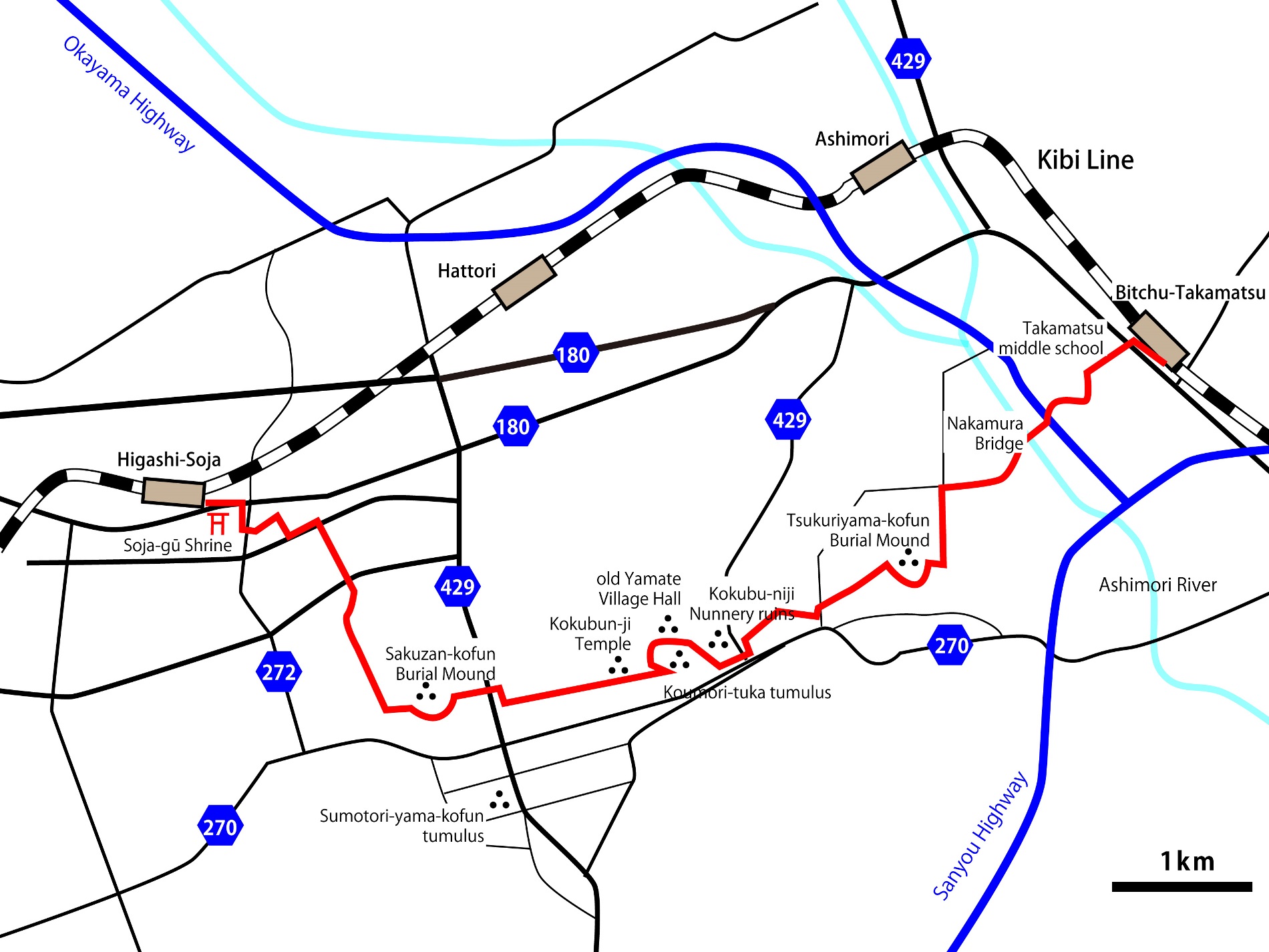
From Bitchu-Takamatsu Station to Tsukuriyama-kofun Burial Mound
Start at Bitchu-Takamatsu Station and head to the Kokubun-ji walking course!
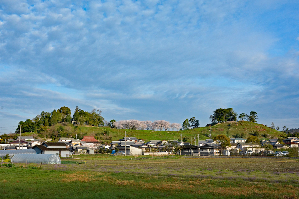
If you turn south at the Takamatsu Junior High School intersection, it's a straight road. When you go under the expressway, you come out to the Ashimori River, where a flock of winter ducks has arrived. You can observe kingfishers on this river. In front of the Nakamura Bridge, you can see a mound shaped hill. The first destination is the Tsukuriyama-kofun Burial Mound. During the rice harvest, egrets gather near the combine harvesters. The Tsukuriyama-kofun Burial Mound (Shinjō, Okayama City) is a keyhole-shaped burial mound, the fourth largest of its kind in Japan. From the road next to the parking lot, you can climb up the stone steps to the top of the mound. Cherry trees have been planted where the mound used to be a field.
A small shrine on top of the Tsukuriyama-kofun Burial Mound
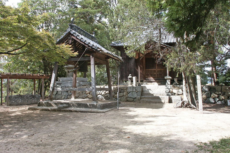
It is said to have been constructed in the early 5th century as a 360-meter-long keyhole-shaped Burial Mound. "Kōujin-sama" is built in the front part of the tomb. It is an active shrine that is still worshiped today. It is rare that the burial mound, which can be freely entered, is open to the public. While picking up big acorns, go down the south side stairs. There are six smaller mounds alongside the stairs, adding to the view. Walk on a path on the south side of the burial mound along the native morning glories and ripe persimmons. See the vegetables, fruit trees, and yellow rice ripening in the fields, and then go out to the Kibiji cycling road.
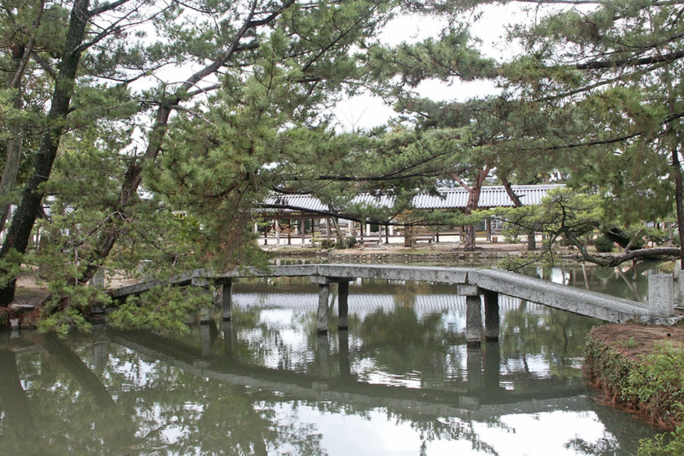
Kokubu-niji Nunnery Ruine
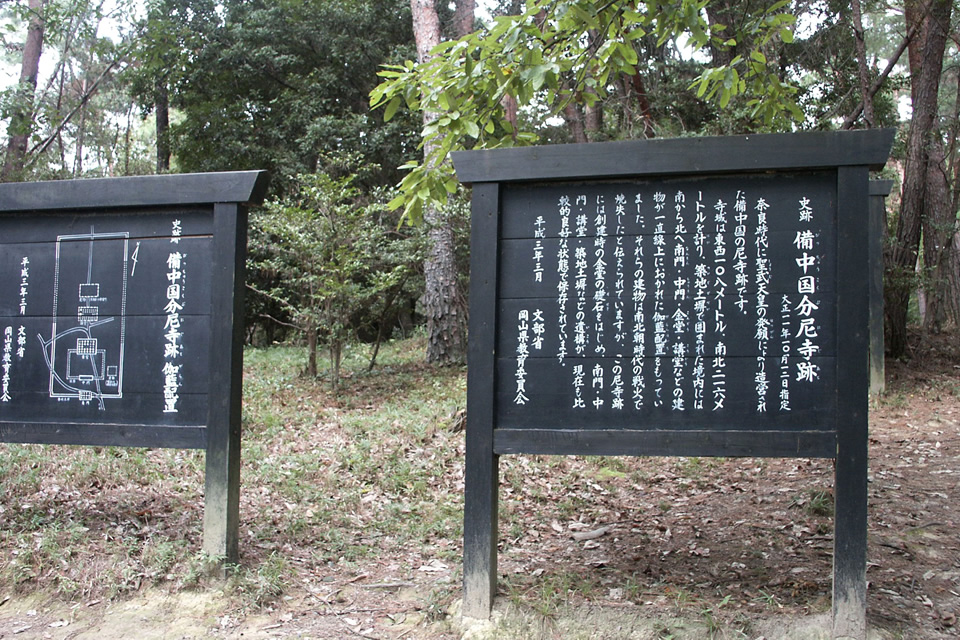
After passing by the ramen and Japanese soba noodle shops, head north into the pine forest. In the forest, there are black painted signs explaining the history of the area scattered about. Neatly remaining here are foundation stones that evoke the presence of the ancient temple that once stood here. The temple grounds were reportedly massive, with a length of 108 meters east to west and a width of 225 meters north to south, rivaling those of the temples in Nara. Walk about 300 meters to the northwest on the path south of the Kokubu-niji Nunnery Ruins to reach the Kibiji Folk Museum.
Old Yamate Village Hall
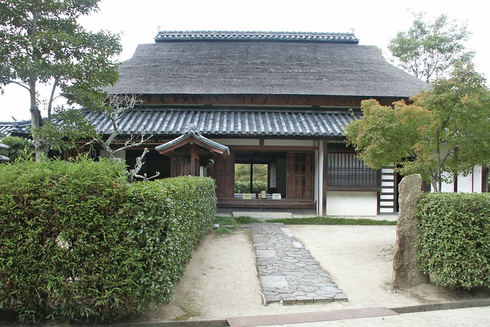
On the grounds of the Kibiji Folk Museum, there are relocated old buildings such as the old Yamate Village Hall and the old Matsui family's house. Both were built in the late Edo period and their thatched roofs evoke a sense of nostalgia. It's surprising that the former Yamate Village Hall was used from 1902 to 1968.
There is a red and white plum garden on the south side, which is a popular photo spot with the thatched roof as a background during the blooming season. There are ponds on both sides, and benches that harmonize with nature are maintained, making it a nice place to have a picnic. The Kibiji Folk Museum mainly exhibits archaeological artifacts from the Kofun period.
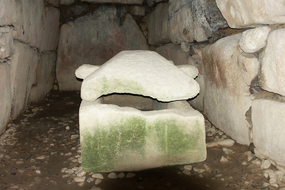
Kōmori-tsuka tumulus
Walking along the path on the north side of the forest by the pond from the Kibiji Folk Museum, you will find the Matsui well on the north side of the pond. Although it is an old well that is no longer used today, it is said that a Waka poem composed by Fujiwara no Mochiakira during the Daijōsai ceremony at the enthronement of Emperor Go-Shirakawa has been passed down. The waka goes like this:
"Our hearts are bound tightly,
Matsui's crystal waters, clear,
Reflect only you,
Like the eternal shadow we share."
You can feel that it was once a famous spring water. With the cosmos flowers to your left, you can enter the Kōmori-tuka tumulus from the south side of the forest. This mound is a keyhole-shaped mound that utilizes a natural hill from the late 6th century, and you can enter the interior of the stone chamber. The stone chamber is magnificent.
Kokubun-ji Five-tiered Pagoda
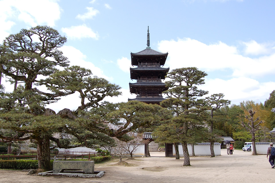
When descending from the Komori-tsuka tumulus, Kokubun-ji spreads to the west. Kokubun-ji and Kokubun-niji Nunnery were established by the decree of Emperor Shomu in the Nara period. The temples at the time of their foundation were destroyed by the fires of the Nanboku-cho period.
Subsequently, the temples were abandoned and were later revived during the middle of the Edo period with the assistance of the feudal Makita family as the Nissho-zan Kokubun-ji. The current five-tiered pagoda was rebuilt during the Edo period and was dismantled and repaired during the Heisei period.
Kokubun-ji Main Hall
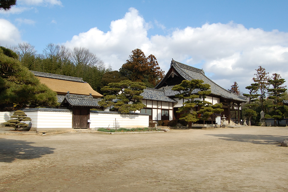
Upon entering the gate, there is a thatched-roof guest hall in front, the main hall to the east, and the priest's quarters and reception hall to the west. In the garden to the west, a carefully-cultivated pine tree stands tall, and behind it, the five-tiered pagoda pierces the blue sky. The Old Sanyodo Road runs along the southern side of Kokubun-ji Temple and was likely an important transportation hub.
Peach Blossoms and Five-tiered Pagoda
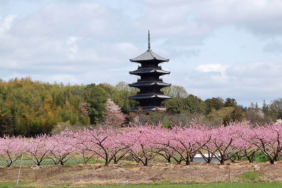
The scenery centered around the five-tiered pagoda is a symbol of the Kibiji region. With plum, rapeseed flowers, cherry blossoms, peach blossoms, astragalus flowers, rice paddies, golden rice stalks, persimmons, sunsets, and sunrises, there is no shortage of photographic subjects. The fields and villages around Kokubun-ji are daily efforts to preserve this landscape for future generations. During Golden Week, events are held in the Kokubun-ji area.
Sumōtori-yama tumulus
If you walk along the bicycle path from Kokubunji and cross the two-lane Route 429, you will see Sakuzan-kofun Burial Mound facing the west side.
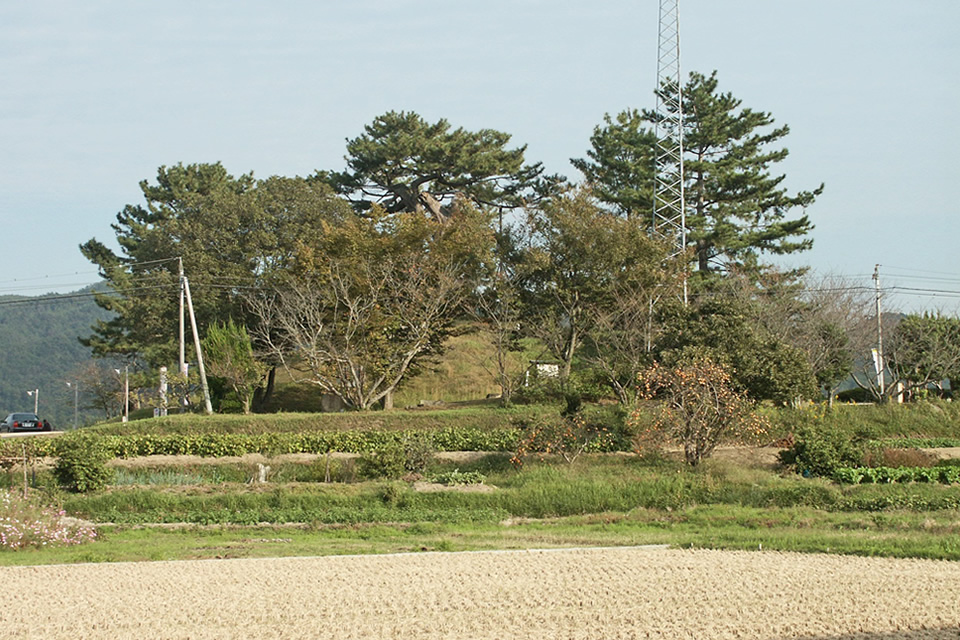
If you have time, visit Sumōtori-yama tumulus about 700 meters to the south. You'll recognize it by the large pine tree towering over the rice paddies. Although there is now only one pine tree, it's a magnificent one, so take a look. This is a rare rectangular burial mound in Japan. A dohyo, or sumō wrestling ring, was set up on the west side of the mound, and it's said to have been named Sumōtori-yama because sumō wrestling matches were dedicated during the autumn festival of the guardian deity.
Sakuzan-kofun Burial Mound
The first burial mound visited on this walk is the Tsukuriyama-kofun Burial Mound (Shinjō, Okayama City), which is also called the Sakuzan-kofun Burial Mound (Misu, Soja City). It is the second largest burial mound in Okayama Prefecture, after the Tsukuriyama-kofun Burial Mound. Walk along the road at the foot of the mound in a clockwise direction and you will come to a parking lot on the west side. From here, there is a path that leads up to a keyhole-shaped burial mound. Walk north along the foothills and head towards Soja-gū Shrine.
Shikoku Pilgrimage (a pilgrimage of 88 temples in Shikoku)
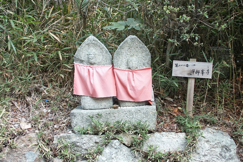
The foot of the hills surrounding the Sakuzan-kofun burial mound is dotted with stone statues that have been enshrined. Beside each statue is a plaque bearing the name of one of the 88 temples of the Shikoku Pilgrimage. When asked about the history of the statues, locals explain that they were erected during an outbreak of disease in the area, though the exact timing is unclear. Each statue is maintained by a different family. Walking among them gives one the sense of undertaking a pilgrimage to the 88 temples of Shikoku.
After crossing the two-lane bypass, walk along the ditch and you will come to a corner where there is a pachinko parlor on the street leading to the city hall. Just a short distance westward is a Japanese confectionery shop called Hirakawa where you can buy manju, a traditional Japanese sweet, as a souvenir. Passing the Aoyama in clothes store, turn north at the next traffic light and you will find Soja-gū Shrine 400 meters ahead.
Soja-gū Shrine
Soja is a nationwide shrine that was established during the Ritsuryo system of the Heian period. This region developed as a temple town of the Soja-gū Shrine in the medieval period, and the name of the shrine became the name of the area. The main hall built in the Edo period was destroyed by a fire in 1977, but the long corridor remains, and the pine trees in the Mishima-style garden retain a unique charm in the style of the Heian period.
If you walk 400 meters west from Soja-gū Shrine, you will reach Higashi-Soja Station. Although it took about four hours to travel, the course was full of variety and never boring.